Three Instruments, Three Answers, One Atmosphere
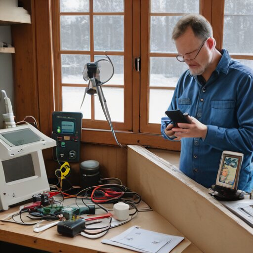
The barometric pressure on my phone says 1018 hPa. The Davis Vantage Pro 2 console, fresh out of the box, says 939 hPa. The METAR for CYEG, which I trust because it’s what I set my altimeter to before every flight, says 1016 hPa. That’s a 79-hectopascal spread across three instruments claiming to measure the same invisible thing.
My hobby is collecting hobbies, and hobby number seventy-seven is already teaching me that I don’t understand pressure nearly as well as I thought.
The problem, I eventually discover after an hour of increasingly irritated Googling, is elevation correction. A barometer measures the actual weight of the atmosphere above it. My garage is 668 metres above sea level. The column of air above me is shorter than the column above a sensor at sea level, so the raw pressure reading is lower. Weather reports use “sea level pressure”—the reading corrected as if my garage were at the ocean’s edge. The Davis console ships with no correction applied. My phone is silently pulling the METAR and pretending it measured it locally.
I knew this. Every pilot knows this. When I parse A3038 from an aviation weather report, I’m reading the altimeter setting—pressure expressed in inches of mercury, already corrected to sea level. The reason pilots need it is precisely because pressure changes with altitude and weather simultaneously. A barometer can’t tell whether you climbed 300 feet or a cold front rolled in. Same instrument, different assumptions about what’s held constant.
And yet somehow, standing in my garage with a $400 weather station that disagrees with my phone by three percent, I had to rediscover this from first principles. Twenty-nine years of flying and I’d never once thought about what the barometer in my kitchen was actually measuring.
The Davis manual explains the correction process on page 47. You enter your station elevation, and it applies a fixed offset to convert raw pressure to sea level equivalent. I punch in 668 metres. The display recalculates. Now it reads 1015 hPa—one hectopascal off from the METAR, which is probably just timing. I feel like I’ve accomplished something, except all I’ve done is teach a computer my altitude.
The anemometer is worse.
Environment Canada has siting requirements I can’t possibly meet. The recommendation is to place wind sensors at least twice as far from any obstacle as that obstacle’s height. My garage is 4 metres tall. That means the anemometer should be 8 metres away. The fence is 2 metres; add 4 metres of clearance. The spruce behind the house—the one I cored for dendrochronology a few weeks ago—is probably 12 metres. I’d need to mount the sensor in the middle of the back lawn, on a pole tall enough to clear the roofline turbulence, which means at least 3 metres above ground, ideally more.
None of this is happening today. What I have is a tripod mount clamped to the deck railing, reading wind speeds that are probably 40% low because of the house’s shadow effect. The wind on my phone shows 22 km/h from the northwest. My anemometer shows 11 km/h, gusting to 14. It’s not wrong, exactly. It’s measuring the wind where the sensor happens to be, which is in a sheltered microclimate created by the structure I live in.
The Stevenson screen kit is still in its box. I’d planned to assemble it this afternoon—louvered sides, double roof, proper ventilation—but I’m looking at the instructions and the door has to face north. The north side of my property is the fence. If I mount the screen there, I’m measuring the temperature of the fence’s radiative shadow. If I mount it on the south side, I’m violating 160 years of meteorological convention and every reading becomes incomparable to any official station.
When I built the Nixie tube METAR display last month, I was pulling weather data from the professionals. CYEG has a properly sited Automated Surface Observing System maintained by Nav Canada, calibrated to standards I don’t have to think about. The numbers it gives me are trustworthy because someone else worried about elevation correction and obstacle clearance and sensor placement. I just parsed the string and made the tubes glow.
Now I’m trying to be the source instead of the consumer, and the gap between “weather enthusiast” and “weather station” is measured in real estate I don’t have.
The CWOP network—Citizen Weather Observer Program—will happily accept my data and feed it into NOAA forecast models. Over 13,000 amateur stations worldwide contribute this way, including plenty routed through APRS, which I’ve been using for balloon telemetry and position tracking for years. The infrastructure is familiar. I could have this station reporting within the hour.
But the quality control documentation is sobering. MADIS runs automated consistency checks. Stations that report values too far from their neighbours get flagged. Persistent outliers get filtered out of the forecast models entirely. The whole point of citizen weather observation is density—more sample points across the landscape—but only if those points are accurate enough to improve the model rather than degrade it.
My deck-mounted anemometer is going to show artificially calm winds. My thermometer, once I site the screen wherever I can fit it, is going to run warm in summer from the nearby pavement. My rain gauge is going to undercatch because the roofline creates turbulence that deflects precipitation.
I’ll get data. Lots of data. But data isn’t the same as measurement.
The console is on the kitchen counter now, blinking its corrected pressure at me. One hectopascal off from the airport. That part, at least, I can trust.